 |
 |
|
||||
|
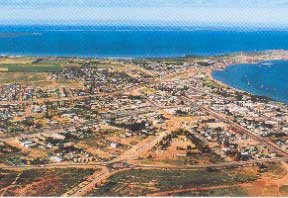
Images and information placed above are from www.airportsaustralia.com We thank them for the data!
Runway 17/353327 x 98 feet
|
|||||||||||||||||||||||||||||||||||||||||||||||||||||||||||||||||||||||||||||||||||||||||||||||||||||||||||||||||||||||||||||||||||||||||||||||||||||||||||||||||||||||||||||||||||||||||||||||||||||||||||||||||||||||||
| Runway 17 | |
|---|---|
| Surface | GRAVEL. |
| True Heading | 173.0 |
| Latitude | -32.126631 32° 07' 35.87" S |
| Longitude | 133.712628 133° 42' 45.46" E |
| Elevation | 73.0 feet 22 meters |
| Slope | -0.1° |
| Landing Distance | 3327 feet 1014 meters |
| Takeoff Distance | 3327 feet 1014 meters |
| Lighting System | PORTABLE |
| Runway 35 | |
|---|---|
| Surface | GRAVEL. |
| True Heading | 353.0 |
| Latitude | -32.135703 32° 08' 08.53" S |
| Longitude | 133.713883 133° 42' 49.98" E |
| Elevation | 71.0 feet 22 meters |
| Slope | 0.1° |
| Landing Distance | 3327 feet 1014 meters |
| Takeoff Distance | 3327 feet 1014 meters |
| Lighting System | PORTABLE |
| Runway 11 | |
|---|---|
| Surface | ASPHALT |
| True Heading | 111.0 |
| Latitude | -32.127839 32° 07' 40.22" S |
| Longitude | 133.698017 133° 41' 52.86" E |
| Elevation | 53.0 feet 16 meters |
| Slope | 0.4° |
| Landing Distance | 5709 feet 1740 meters |
| Takeoff Distance | 5709 feet 1740 meters |
| Lighting System | PCL
LIRL PORTABLE |
| Runway 29 | |
|---|---|
| Surface | ASPHALT |
| True Heading | 291.0 |
| Latitude | -32.133417 32° 08' 00.30" S |
| Longitude | 133.715261 133° 42' 54.94" E |
| Elevation | 74.0 feet 23 meters |
| Slope | -0.4° |
| Landing Distance | 5709 feet 1740 meters |
| Takeoff Distance | 5709 feet 1740 meters |
| Lighting System | PCL
LIRL PORTABLE |
| CEDUNA | |||||
|---|---|---|---|---|---|
| Type | ID | Channel | Freq | Country | State |
| NDB | CDU | - | 293 | Australia | - |
| Latitude | Longitude | Airport |
| -32.126667 32° 07' 36.00" S |
133.726944 133° 43' 37.00" E |
YCDU |
The content above was published at Airports-Worldwide.com in 2004-2006.
We don't guarantee the information is fresh and accurate. The data may be wrong or outdated.
For more up-to-date information please refer to other sources.

 |
|
Copyright 2004-2024 © by Airports-Worldwide.com, Vyshenskoho st. 36, Lviv 79010, Ukraine Legal Disclaimer |
 Operator: District Council of Ceduna