|
 |
|
||||
|
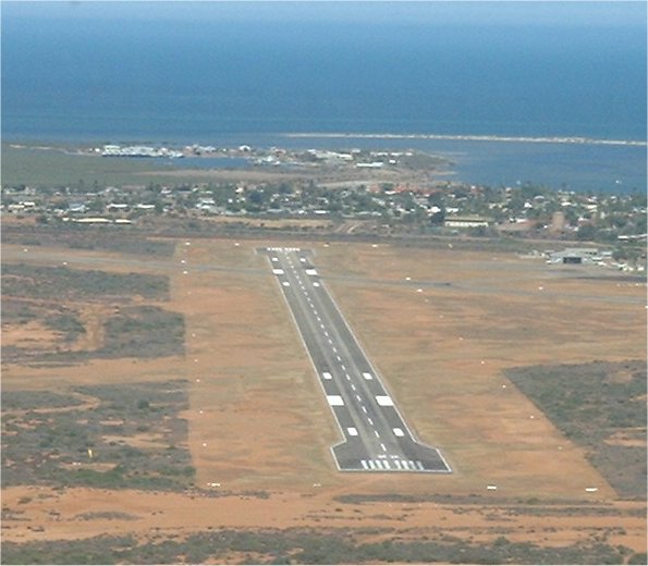
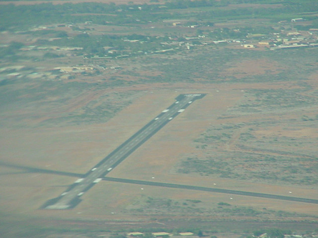
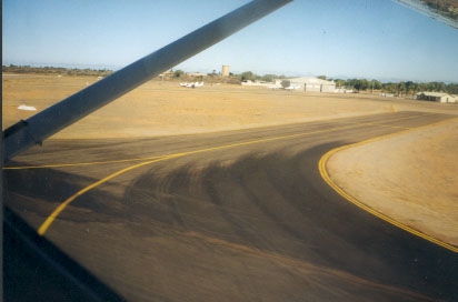
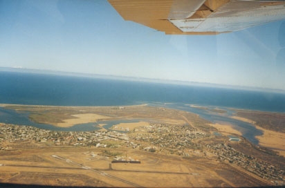
Images and information placed above are from www.airportsaustralia.com http://www.flightclub.com.au/wa-airstrips/carnarvon/
Runway 04/225509 x 98 feet
|
|||||||||||||||||||||||||||||||||||||||||||||||||||||||||||||||||||||||||||||||||||||||||||||||||||||||||||||||||||||||||||||||||||||||||||||||||||||||||||||||||||||||||||||||||||||||||||||||||||||||||||||||||||||||||||||||||||||||||||||||||||||||||||||||||||||||||
| Runway 04 | |
|---|---|
| Surface | ASPHALT |
| True Heading | 043.0 |
| Latitude | -24.886686 24° 53' 12.07" S |
| Longitude | 113.663939 113° 39' 50.18" E |
| Elevation | 7.0 feet 2 meters |
| Slope | 0.1° |
| Landing Distance | 5509 feet 1679 meters |
| Takeoff Distance | 5509 feet 1679 meters |
| Lighting System | PCL
LIRL VA |
| Runway 22 | |
|---|---|
| Surface | ASPHALT |
| True Heading | 223.0 |
| Latitude | -24.875658 24° 52' 32.37" S |
| Longitude | 113.675342 113° 40' 31.23" E |
| Elevation | 13.0 feet 4 meters |
| Slope | -0.1° |
| Landing Distance | 5387 feet 1642 meters |
| Takeoff Distance | 5509 feet 1679 meters |
| Displaced Threshold Length | 122 feet 37 meters |
| Lighting System | PCL
LIRL VA |
| Runway 18 | |
|---|---|
| Surface | ASPHALT |
| True Heading | 179.0 |
| Latitude | -24.878733 24° 52' 43.44" S |
| Longitude | 113.666328 113° 39' 58.78" E |
| Elevation | 9.0 feet 3 meters |
| Slope | -0.1° |
| Landing Distance | 3740 feet 1140 meters |
| Takeoff Distance | 3740 feet 1140 meters |
| Runway 36 | |
|---|---|
| Surface | ASPHALT |
| True Heading | 359.0 |
| Latitude | -24.888881 24° 53' 19.97" S |
| Longitude | 113.666464 113° 39' 59.27" E |
| Elevation | 7.0 feet 2 meters |
| Slope | 0.1° |
| Landing Distance | 3740 feet 1140 meters |
| Takeoff Distance | 3740 feet 1140 meters |
| CARNARVON | |||||
|---|---|---|---|---|---|
| Type | ID | Channel | Freq | Country | State |
| NDB | CAR | - | 323 | Australia | - |
| Latitude | Longitude | Airport |
| -24.886667 24° 53' 12.00" S |
113.669167 113° 40' 09.00" E |
YCAR |
| CARNARVON | |||||
|---|---|---|---|---|---|
| Type | ID | Channel | Freq | Country | State |
| VOR-DME | CAR | 077X | 113 | Australia | - |
| Latitude | Longitude | Airport |
| -24.881944 24° 52' 55.00" S |
113.672778 113° 40' 22.00" E |
YCAR |
The content above was published at Airports-Worldwide.com in 2004-2006.
We don't guarantee the information is fresh and accurate. The data may be wrong or outdated.
For more up-to-date information please refer to other sources.

 |
|
Copyright 2004-2024 © by Airports-Worldwide.com, Vyshenskoho st. 36, Lviv 79010, Ukraine Legal Disclaimer |
 Operator: Shire of Carnarvon