 |
|
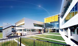
Canberra International Airport |
 Our Vision
The Capital Airport Group's vision is to develop Canberra International Airport as a first class facility to serve the region's evolving transportation needs and to maximise the airport's contribution to the region's economy.
Year 2020 Master Plan
Canberra International Airport, in accordance with the Airports Act 1996, has prepared a Master Plan to address planning concepts and a vision for the airport. The Master Plan for Canberra International Airport was approved by the Minister of Transport & Regional Services on 24 August 1999. It is the most definitive planning document ever produced for Canberra International Airport and provides a broad strategic outlook on the potential for the airport over the next 20 years.
The detailed objectives addressed in the Master Plan are to:
- Ensure the airport is operated and developed in a safe, comfortable, secure and environmentally sustainable manner.
- Develop a culture of excellence based on customer service and value for money.
- Ensure that the design of the airport reflects its role as a gateway to the National Capital.
- Optimise the social and economic benefits of the airport to the Australian Capital Region.
- Provide a business environment that allows the airport and its associated businesses to reach their potential.
- Develop Canberra International Airport as a regional multi-modal transport hub for passenger and freight connections.
- Provide the flexibility to handle international operations on a demand basis.
- Adopt best possible technology to improve all-weather utilisation of the airport.
On-Airport Environmental Management
Capital Airport Group is committed to managing Canberra International Airport in an environmentally responsible manner.
A comprehensive approach to Airport environmental management involves addressing on-airport environment issues and the off-airport environment issues of aircraft noise.
Capital Airport Group has developed an Environmental Management Strategy, which is a five year plan to address every day environmental issues that arise from the operational activities at the airport. This strategy was approved by the Minister for Transport & Regional Services on 24 August 1999.
Capital Airport Group
Level 1
2 Brindabella Circuit
Brindabella Business Park
CANBERRA AIRPORT ACT 2609
Recorded Message (+61 2) 6275 2236
Switchboard (+61 2) 6275 2222
Facsimile (+61 2) 6275 2244
n mccann at capitalairportgrp com au
j mullaney at capitalairportgrp com au
URL: Canberra International Airport
Images and information placed above are from
Canberra International
Airport
We thank them for the data!
| General Info
|
| Country |
Australia
|
| ICAO ID |
YSCB
|
| Time |
UTC+10(+11DT)
|
| Latitude |
-35.306944
35° 18' 25.00" S
|
| Longitude |
149.195000
149° 11' 42.00" E
|
| Elevation |
1886 feet
575 meters
|
| Type |
Civil
|
| Magnetic Variation |
012° E (01/04)
|
| Beacon |
Yes
|
| Operating Agency |
CIVIL GOVERNMENT, (LANDING FEES AND DIPLOMATIC CLEARANCE MAY BE REQUIRED)
|
| Alternate Name |
FAIRBAIRN
|
| International Clearance Status |
Airport of Entry
|
| Communications
|
TWR
1930-1300Z++ Sun-Fri, 1930-1200Z++ Sat.
|
118.7
|
MTAF
Outside twr hrs.
|
118.7
|
| GND CLNC DEL |
121.7
|
MELBOURNE CNTR
Outside twr hrs.
|
125.9
|
| ATIS |
116.7
127.45
263.0
|
APP
1930-1300Z++ Sun-Fri, 1930-1200Z++ Sat.
|
124.5
125.9
Within 30 NM of CB; 124.5 E of Rwy 17/35, 125.9 W of Rwy 17/35
|
| Communications Remarks |
|
| MISC |
Nstd wi CTLZ to 5500'.
|
| FSS |
(on gnd)
|
| Runways
|
| ID |
Dimensions |
Surface |
PCN |
ILS
|
| 12/30 |
5509 x 148 feet
1679 x 45 meters |
ASPHALT |
016FCYU |
NO
|
| 17/35 |
8802 x 148 feet
2683 x 45 meters |
ASPHALT |
035FBYU |
YES
|
| Navaids
|
| Type |
ID |
Name |
Channel |
Freq |
Distance From Field |
Bearing From Navaid
|
| VOR-DME |
CB |
CANBERRA |
114X |
116.7 |
1.5 NM |
169.1
|
| NDB |
CCK |
CHURCH CREEK |
- |
248 |
9.4 NM |
347.6
|
| Supplies/Equipment
|
| Fuel |
Jet A1, without icing nhibitor.
100/130 MIL Spec, low lead, aviation gasoline (BLUE)
|
| Oil |
O-117, 1100, Reciprocating Engine Oil (MIL L 6082)
O-156, MIL L 23699 (Synthetic Base)Turboprop/Turboshaft Engine
|
| Other Fluids |
LPHOX, Low pressure oxygen servicing
OX, Indicates oxygen servicing when type of servicing is unknown
|
| JASU |
|
| Remarks
|
| CAUTION |
Bird haz. Dragstrip parl and to the left of Rwy 30 may be mistaken for rwy.
|
| FLUID |
LPOX
|
| FUEL |
(NC-A1) Avbl 0600-2200Z++. (NC-100LL) Avbl 1900-0900Z++.
|
| JASU |
E1
|
| LGT |
Arpt bcn lctd at Mt Ainslie 307 2.7 NM to Fld. Activate Rwy 12-30 and 17-35 - 118.7 outside twr hr. Portable lgt PN.
|
| MISC |
Ldg fees. Rwy 17-35 grooved.
|
| NS ABTMT |
See FLIP PLANNING AP/3.
|
| OIL |
O-117-156
|
| RSTD |
Imposed rwy wt limits Rwy 17-35: C5-639,000 lb; C141-260,000 lb.
|
Runway 12/30
5509 x 148 feet
1679 x 45 meters
| Runway 12
|
| Surface |
ASPHALT
|
| True Heading |
130.0
|
| Latitude |
-35.302242
35° 18' 08.07" S
|
| Longitude |
149.183950
149° 11' 02.22" E
|
| Elevation |
1849.0 feet
564 meters
|
| Slope |
0.7°
|
| Landing Distance |
5509 feet
1679 meters
|
| Takeoff Distance |
5509 feet
1679 meters
|
| Lighting System |
PCL
MIRL
PORTABLE |
| Runway 30
|
| Surface |
ASPHALT
|
| True Heading |
310.0
|
| Latitude |
-35.311933
35° 18' 42.96" S
|
| Longitude |
149.198106
149° 11' 53.18" E
|
| Elevation |
1886.0 feet
575 meters
|
| Slope |
-0.7°
|
| Landing Distance |
5295 feet
1614 meters
|
| Takeoff Distance |
5509 feet
1679 meters
|
| Displaced Threshold Length |
214 feet
65 meters
|
| Lighting System |
PCL
MIRL
PAPI
PORTABLE |
Runway 17/35
8802 x 148 feet
2683 x 45 meters
| Runway 17
|
| Surface |
ASPHALT
|
| True Heading |
180.0
|
| Latitude |
-35.292200
35° 17' 31.92" S
|
| Longitude |
149.193239
149° 11' 35.66" E
|
| Elevation |
1874.0 feet
571 meters
|
| Slope |
0.0°
|
| Landing Distance |
8802 feet
2683 meters
|
| Takeoff Distance |
8982 feet
2738 meters
|
| Overrun Length |
180 feet
55 meters
|
| Overrun Surface |
ASPHALT
|
| Lighting System |
PCL
HIRL
VA
PORTABLE |
| Runway 35
|
| Surface |
ASPHALT
|
| True Heading |
360.0
|
| Latitude |
-35.316353
35° 18' 58.87" S
|
| Longitude |
149.193242
149° 11' 35.67" E
|
| Elevation |
1870.0 feet
570 meters
|
| Slope |
0.0°
|
| Landing Distance |
8802 feet
2683 meters
|
| Takeoff Distance |
8802 feet
2683 meters
|
| Lighting System |
PCL
HIRL
A1
VA
PORTABLE |
Navaids
| CANBERRA
|
| Type |
ID |
Channel |
Freq |
Country |
State
|
| NDB |
CB |
- |
263 |
Australia |
-
|
| Latitude |
Longitude |
Airport
|
-35.297222
35° 17' 50.00" S |
149.190556
149° 11' 26.00" E |
YSCB
|
| CANBERRA
|
| Type |
ID |
Channel |
Freq |
Country |
State
|
| VOR-DME |
CB |
114X |
116.7 |
Australia |
-
|
| Latitude |
Longitude |
Airport
|
-35.281389
35° 16' 53.00" S |
149.195833
149° 11' 45.00" E |
YSCB
|
Navaids
| CHURCH CREEK
|
| Type |
ID |
Channel |
Freq |
Country |
State
|
| NDB |
CCK |
- |
248 |
Australia |
-
|
| Latitude |
Longitude |
Airport
|
-35.464167
35° 27' 51.00" S |
149.194722
149° 11' 41.00" E |
YSCB
|
The content above was published at Airports-Worldwide.com in 2004-2006.
We don't guarantee the information is fresh and accurate. The data may be wrong or outdated.
For more up-to-date information please refer to other sources.
|
 |


