|
|
|
|
|
|
 Broome and Broome International Airport are established as the
regional hub of northwest Australia and the Gateway to the Kimberley.
Broome and Broome International Airport are established as the
regional hub of northwest Australia and the Gateway to the Kimberley.
Serving business, personal and tourist travellers, BIA has around 250,000
passengers go through its gates each year, making it the major regional
airport in WA.
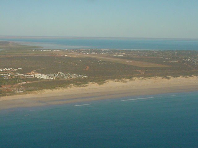
Broome is a rapidly expanding town with a growing town with a growing
tourist industry. Visitors are attracted to the warm climate, turquoise
waters and beautiful beaches. Broome International Airport is the major
air hub of northwest Australia and the Gateway to the Kimberley.
History
When the Geraldton-Derby airmail service first landed at Broome in 1922,
the "airport" was any smooth patch of sand on Cable Beach. Sometime in
the mid 1920s, a dirt strip was graded adjacent to the old race course,
near the airport's current location.
By 1935, the east-west airstrip was laid out in its present alignment.
As aircraft became larger and faster, the runway expanded but the airport
was really nothing more than a graded strip and a covered shed for a "terminal".
World War II saw a dramatic increase in activity as Broome Airport was
a refuelling stop for military aircraft in the northwest region. In addition,
Broome's Roebuck Bay became a stopover for huge flying boats evacuating
Dutch refugees from Java, which was in the path of advancing Japanese
troops.
The war reached Broome on March 3, 1942 when Japanese fighters attacked
Broome Airport and the flying boats at anchor in the bay.
Over 70 passengers in the flying boats were killed, just minutes before
their scheduled takeoff. The complete story of this tragic day is detailed
in ebroome.com/history.
 In the immediate aftermath of the attack, Japanese Invasion hysteria was
so great that the airport runway was ordered destroyed. At the last minute
cooler heads prevailed and the order was rescinded. Nevertheless, Broome
was virtually abandoned after the attack - there were ongoing fears of
the invasion that never came.
In the immediate aftermath of the attack, Japanese Invasion hysteria was
so great that the airport runway was ordered destroyed. At the last minute
cooler heads prevailed and the order was rescinded. Nevertheless, Broome
was virtually abandoned after the attack - there were ongoing fears of
the invasion that never came.
After the war, some determined pearlers returned to Broome hoping to regain
the riches of years past. Although the industry did revive somewhat, previous
shell prices were never realised. Also, the advent of plastics in the
1950s seriously eroded the demand for mother of pearl shell - the main
product of Broome's pearling industry.
Fortunately for Broome and its pearling industry, experiments with cultured
pearls were producing exciting results, with the prospect of pearls replacing
pearl shell as the money making product. By the 1970s pearl farms were
established in coastal waters, producing thousands of beautiful pearls
- and reaping millions of dollars. Prosperity finally returned to Broome.
With prosperity came new residents and there was a steady tourism increase
in Broome and the Kimberley region - and Broome Airport was the main link
to the region.
|
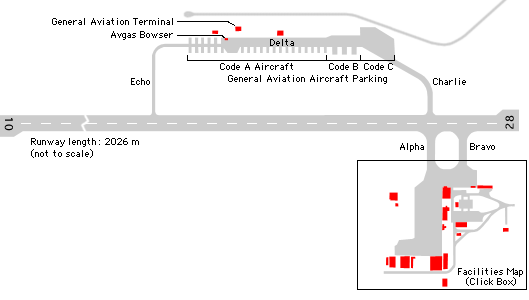 |
Photo credit: Broome Airport |
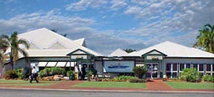
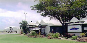
Broome Airport underwent several stages of expansion, with the first
major improvements in 1991 when Airport Engineering Services purchased
the airport from the Federal Department of Transport. This transition
from government to private operations marked the beginning of a new era
for Broome's airport. The next step will be the relocation of the airport
to its new site just to the northeast of Broome.
Broome International Airport
PO Box 68
Broome
Western Australia 6725
Telephone: (08) 9193 5455
International: +61 8 9193 5455
Facsimile: (08) 9193 6057
E-mail: admin at broomeair com au
Corporate Headquarters
Broome International Airport
(ABN 99 074 187 732)
53 Wheatley Street
Gosnells
Western Australia 6110
Telephone: (08) 9490 2299
International: +61 8 9490 2299
Facsimile: (08) 9490 1775
E-mail: info at broomeair com au
URL: Broome Airport
|
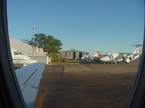 |
Photo credit: Transport (WA Govt)
(Click on the photo to enlarge) |
|
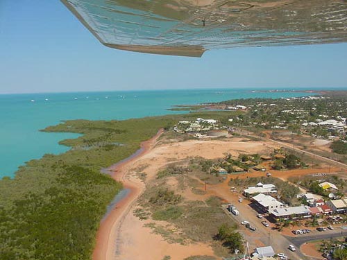 |
Photo credit: Transport (WA Govt)
(Click on the photo to enlarge) |
|
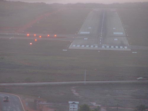 |
Photo credit: Transport (WA Govt)
(Click on the photo to enlarge) |
|
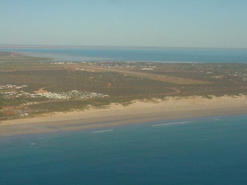 |
Photo credit: Transport (WA Govt)
(Click on the photo to enlarge) |
|
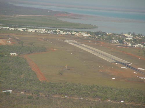 |
Photo credit: Transport (WA Govt)
(Click on the photo to enlarge) |
Images and information placed above are from
Broome Airport
http://www.flightclub com au/wa-airstrips/broome/
We thank them for the data!
| General Info
|
| Country |
Australia
|
| ICAO ID |
YBRM
|
| Time |
UTC+8
|
| Latitude |
-17.944722
17° 56' 41.00" S
|
| Longitude |
122.231667
122° 13' 54.00" E
|
| Elevation |
57 feet
17 meters
|
| Magnetic Variation |
002° E (01/04)
|
| Operating Agency |
CIVIL GOVERNMENT, (LANDING FEES AND DIPLOMATIC CLEARANCE MAY BE REQUIRED)
|
| Communications
|
| MTAF UNICOM |
126.0
|
| BRISBANE CNTR |
123.9
|
| ATIS |
126.55
|
| Communications Remarks |
|
| MISC |
Nstd wi 30 NM to 10000'.
|
| FSS |
(on gnd)
|
| Runways
|
| ID |
Dimensions |
Surface |
PCN |
ILS
|
| 10/28 |
8064 x 148 feet
2458 x 45 meters |
ASPHALT |
034FBYT |
NO
|
| Navaids
|
| Type |
ID |
Name |
Channel |
Freq |
Distance From Field |
Bearing From Navaid
|
| NDB-DME |
BRM |
BROOME |
100X |
320 |
At Field |
-
|
| Supplies/Equipment
|
| Fuel |
Jet A1+, Jet A1 with icing inhibitor.
Jet A1, without icing nhibitor.
|
| Oil |
O-117, 1100, Reciprocating Engine Oil (MIL L 6082)
|
| Remarks
|
| CAUTION |
Bird haz. Possible poor rdo trans in MTAF area fr acft on gnd or opr lo level. Rdo mast 170' AGL. 192 1.42 NM fr arpt. PJE Jun-Sep.
|
| CSTMS/AG/IMG |
Avbl PN rqr.
|
| FUEL |
Avbl wkd 2300-1000Z, wkend 2300-0900Z, fone C08 9193 5686. OT 1 Hr PN fone C0418 938027. (NC-100LL, A1)
|
| LGT |
ACTIVATE-Rwy 10-28 -119.6, PAL activated SS-SR only.
|
| MISC |
Ldg fee.
|
| OIL |
O-117.
|
| RSTD |
RWY 28 all acft abv 44000 lbs must roll thru RWY 10 TDZ for 180 turns
|
Runway 10/28
8064 x 148 feet
2458 x 45 meters
| Runway 10
|
| Surface |
ASPHALT
|
| True Heading |
105.0
|
| Latitude |
-17.945556
17° 56' 44.00" S
|
| Longitude |
122.215556
122° 12' 56.00" E
|
| Elevation |
56.0 feet
17 meters
|
| Slope |
-0.4°
|
| Landing Distance |
7769 feet
2368 meters
|
| Takeoff Distance |
8064 feet
2458 meters
|
| Displaced Threshold Length |
295 feet
90 meters
|
| Lighting System |
PCL
LIRL
PAPI |
| Runway 28
|
| Surface |
ASPHALT
|
| True Heading |
285.0
|
| Latitude |
-17.951361
17° 57' 04.90" S
|
| Longitude |
122.237950
122° 14' 16.62" E
|
| Elevation |
22.0 feet
7 meters
|
| Slope |
0.4°
|
| Landing Distance |
7375 feet
2248 meters
|
| Takeoff Distance |
8064 feet
2458 meters
|
| Displaced Threshold Length |
689 feet
210 meters
|
| Lighting System |
PCL
LIRL
PAPI |
Navaids
| BROOME
|
| Type |
ID |
Channel |
Freq |
Country |
State
|
| NDB-DME |
BRM |
100X |
320 |
Australia |
-
|
| Latitude |
Longitude |
Airport
|
-17.938056
17° 56' 17.00" S |
122.229722
122° 13' 47.00" E |
YBRM
|
The content above was published at Airports-Worldwide.com in 2004-2006.
We don't guarantee the information is fresh and accurate. The data may be wrong or outdated.
For more up-to-date information please refer to other sources.
|
 |