 |
|
 |
Photo credit: Transport (WA Govt) |
 |
Photo credit: Transport (WA Govt) |
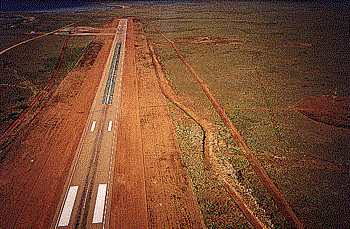
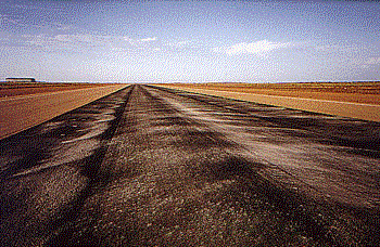
Images and information placed above are from
http://www.flightclub.com.au/wa-airstrips/barrowisland/
We thank them for the data!
| General Info
|
| Country |
Australia
|
| ICAO ID |
YBWX
|
| Time |
UTC+8
|
| Latitude |
-20.864444
20° 51' 52.00" S
|
| Longitude |
115.406111
115° 24' 22.00" E
|
| Elevation |
26 feet
8 meters
|
| Magnetic Variation |
001° E (01/06)
|
| Operating Agency |
PRIVATE
|
| Communications
|
| MELBOURNE CNTR |
122.4
|
| CTAF |
120.1
|
| Communications Remarks |
|
| FSS |
(4000')
|
| Runways
|
ID
|
Dimensions |
Surface |
PCN |
ILS
|
| 03/21 |
6234 x 98 feet 1900 x 30 meters |
ASPHALT |
015FAYT |
NO
|
| Navaids
|
| Type |
ID |
Name |
Channel |
Freq |
Distance From Field |
Bearing From Navaid
|
| NDB |
BWX |
BARROW ISLAND |
- |
206 |
At Field |
-
|
| Supplies/Equipment
|
| Fuel |
Unknown fuel type or whether there is any fuel.
|
| Remarks
|
| CAUTION |
Bird haz.
|
| LGT |
ACTIVATE - Rwy 03-21 and PAPI-120.1. PAPI; Rwy 03-21 MEHT 41'.
|
| RSTD |
PPR. Arpt opr fone C089-478-3388 or C089-184-3714. All turns min speed, max rad.
|
| TFC PAT |
Rwy 03 rgt circuits.
|
Runway 03/21
6234 x 98 feet
1900 x 30 meters
| Runway 03
|
| Surface |
ASPHALT
|
| True Heading |
027.0
|
| Latitude |
-20.868992 20° 52' 08.37" S
|
| Longitude |
115.402619 115° 24' 09.43" E
|
| Elevation |
25.0 feet 8 meters
|
| Slope |
-0.1°
|
| Landing Distance |
6234 feet 1900 meters
|
| Takeoff Distance |
6234 feet 1900 meters
|
| Lighting System |
PCL
LIRL PAPI |
| Runway 21
|
| Surface |
ASPHALT
|
| True Heading |
207.0
|
| Latitude |
-20.853636 20° 51' 13.09" S
|
| Longitude |
115.410778 115° 24' 38.80" E
|
| Elevation |
17.0 feet 5 meters
|
| Slope |
0.1°
|
| Landing Distance |
6234 feet 1900 meters
|
| Takeoff Distance |
6234 feet 1900 meters
|
| Lighting System |
PCL
LIRL PAPI |
Navaids
| BARROW ISLAND
|
| Type |
ID |
Channel |
Freq |
Country |
State
|
| NDB |
BWX |
- |
206 |
Australia |
-
|
| Latitude |
Longitude |
Airport
|
-20.856289 20° 51' 22.64" S |
115.406139 115° 24' 22.10" E |
YBWX |
Thanks to: www.worldaerodata.com
We don't guarantee the information is fresh and accurate. The data may be wrong or outdated.
For more up-to-date information please refer to other sources.
|
 |