 |
 |
|
||||
|
Images and information placed above are from http://www.ballarataeroclub com au/ We thank them for the data!
Runway 05/234150 x 98 feet
|
||||||||||||||||||||||||||||||||||||||||||||||||||||||||||||||||||||||||||||||||||||||||||||||||||||||||||||||||||||||||||||||||||||||||||||||||||||||||||||||||||||||||||||||||||||||||||||||||||||||||||||||||||||||||||||||||||||||||||||||||||||||||||||||||||||||||
| Runway 05 | |
|---|---|
| Surface | ASPHALT |
| True Heading | 062.0 |
| Latitude | -37.512592 37° 30' 45.33" S |
| Longitude | 143.786467 143° 47' 11.28" E |
| Elevation | 1426.0 feet 435 meters |
| Slope | 0.1° |
| Landing Distance | 4150 feet 1265 meters |
| Takeoff Distance | 4150 feet 1265 meters |
| Lighting System | PORTABLE |
| Runway 23 | |
|---|---|
| Surface | ASPHALT |
| True Heading | 242.0 |
| Latitude | -37.507203 37° 30' 25.93" S |
| Longitude | 143.799078 143° 47' 56.68" E |
| Elevation | 1429.0 feet 436 meters |
| Slope | -0.1° |
| Landing Distance | 4150 feet 1265 meters |
| Takeoff Distance | 4150 feet 1265 meters |
| Lighting System | PORTABLE |
| Runway 13 | |
|---|---|
| Surface | GRASS OR EARTH NOT GRADED OR ROLLED. |
| True Heading | 135.0 |
| Latitude | -37.505439 37° 30' 19.58" S |
| Longitude | 143.787400 143° 47' 14.64" E |
| Elevation | 1421.0 feet 433 meters |
| Slope | 0.4° |
| Landing Distance | 1864 feet 568 meters |
| Takeoff Distance | 1864 feet 568 meters |
| Runway 31 | |
|---|---|
| Surface | GRASS OR EARTH NOT GRADED OR ROLLED. |
| True Heading | 315.0 |
| Latitude | -37.509036 37° 30' 32.53" S |
| Longitude | 143.791978 143° 47' 31.12" E |
| Elevation | 1429.0 feet 436 meters |
| Slope | -0.4° |
| Landing Distance | 1864 feet 568 meters |
| Takeoff Distance | 1864 feet 568 meters |
| Runway 18 | |
|---|---|
| Surface | ASPHALT |
| True Heading | 189.0 |
| Latitude | -37.506911 37° 30' 24.88" S |
| Longitude | 143.794933 143° 47' 41.76" E |
| Elevation | 1426.0 feet 435 meters |
| Slope | 0.1° |
| Landing Distance | 4085 feet 1245 meters |
| Takeoff Distance | 4085 feet 1245 meters |
| Lighting System | LIRL |
| Runway 36 | |
|---|---|
| Surface | ASPHALT |
| True Heading | 009.0 |
| Latitude | -37.518000 37° 31' 04.80" S |
| Longitude | 143.792786 143° 47' 34.03" E |
| Elevation | 1431.0 feet 436 meters |
| Slope | -0.1° |
| Landing Distance | 4085 feet 1245 meters |
| Takeoff Distance | 4085 feet 1245 meters |
| Lighting System | LIRL |
| BALLARAT | |||||
|---|---|---|---|---|---|
| Type | ID | Channel | Freq | Country | State |
| NDB | BLT | - | 239 | Australia | - |
| Latitude | Longitude | Airport |
| -37.513611 37° 30' 49.00" S |
143.790556 143° 47' 26.00" E |
YBLT |
The content above was published at Airports-Worldwide.com in 2004-2006.
We don't guarantee the information is fresh and accurate. The data may be wrong or outdated.
For more up-to-date information please refer to other sources.

 |
|
Copyright 2004-2024 © by Airports-Worldwide.com, Vyshenskoho st. 36, Lviv 79010, Ukraine Legal Disclaimer |
 Ballarat is the gateway to much of the best Victoria has to offer, including
the picturesque Goldfields and Pyrenees regions, and the Great Southern
Touring Route comprising of Ballarat, the Grampians and the Great Ocean
Road.
Ballarat is the gateway to much of the best Victoria has to offer, including
the picturesque Goldfields and Pyrenees regions, and the Great Southern
Touring Route comprising of Ballarat, the Grampians and the Great Ocean
Road. 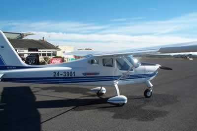 Operator: City of Ballarat