|
 |
|
||||
|
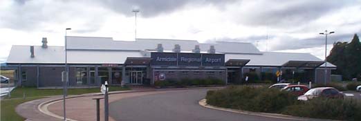
Armidale Airport (IATA: ARM, ICAO: YARM) is an airport in Armidale, New South Wales, Australia. Armidale was one of the twenty destinations looked at by Virgin Blue for services to Sydney using its new Embraer aircraft. As of January 2008, Virgin Blue has not announced the launch of services to Armidale, although it has announced the service to other areas.
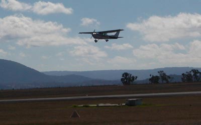
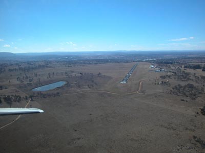
Taking off (Image from http://www.armidale.info/armidalebyair.htm)
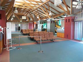
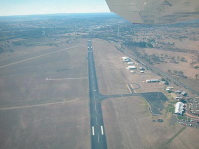
Armidale Airport (Image from http://www.armidale.info/armidalebyair.htm)
Armidale Airport (Image from http://www.armidale.info/armidalebyair.htm)
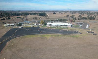
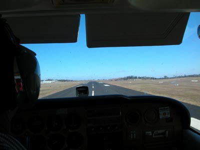
Armidale Airport Runway (Image from http://www.armidale.info/armidalebyair.htm)
Landing (Image from http://www.armidale.info/armidalebyair.htm) * * *
Images and information placed above are from www.airportsaustralia.com http://www.une.edu.au/asera/travel.htm http://en.wikipedia.org/wiki/Armidale_Airport http://www.armidale.info/armidalebyair.htm We thank them for the data!
Runway 05/235702 x 98 feet
|
|||||||||||||||||||||||||||||||||||||||||||||||||||||||||||||||||||||||||||||||||||||||||||||||||||||||||||||||||||||||||||||||||||||||||||||||||||||||||||||||||||||||||||||||||||||||||||||||||||||||||||||||||||||||
| Runway 05 | |
|---|---|
| Surface | ASPHALT |
| True Heading | 058.0 |
| Latitude | -30.532958 30° 31' 58.65" S |
| Longitude | 151.609125 151° 36' 32.85" E |
| Elevation | 3530.0 feet 1076 meters |
| Slope | 0.3° |
| Landing Distance | 5702 feet 1738 meters |
| Takeoff Distance | 5702 feet 1738 meters |
| Lighting System | PCL
LIRL REIL PAPI |
| Runway 23 | |
|---|---|
| Surface | ASPHALT |
| True Heading | 238.0 |
| Latitude | -30.524764 30° 31' 29.15" S |
| Longitude | 151.624542 151° 37' 28.35" E |
| Elevation | 3547.0 feet 1081 meters |
| Slope | -0.3° |
| Landing Distance | 5702 feet 1738 meters |
| Takeoff Distance | 5702 feet 1738 meters |
| Lighting System | PCL
LIRL REIL PAPI |
| Runway 09 | |
|---|---|
| Surface | GRAVEL. |
| True Heading | 097.0 |
| Latitude | -30.524078 30° 31' 26.68" S |
| Longitude | 151.610383 151° 36' 37.38" E |
| Elevation | 3522.0 feet 1074 meters |
| Slope | 0.9° |
| Landing Distance | 3661 feet 1116 meters |
| Takeoff Distance | 3661 feet 1116 meters |
| Runway 27 | |
|---|---|
| Surface | GRAVEL. |
| True Heading | 277.0 |
| Latitude | -30.525297 30° 31' 31.07" S |
| Longitude | 151.621908 151° 37' 18.87" E |
| Elevation | 3555.0 feet 1084 meters |
| Slope | -0.9° |
| Landing Distance | 3661 feet 1116 meters |
| Takeoff Distance | 3661 feet 1116 meters |
| ARMIDALE | |||||
|---|---|---|---|---|---|
| Type | ID | Channel | Freq | Country | State |
| NDB-DME | ARM | 073X | 401 | Australia | - |
| Latitude | Longitude | Airport |
| -30.527778 30° 31' 40.00" S |
151.615278 151° 36' 55.00" E |
YARM |
The content above was published at Airports-Worldwide.com in 2004-2006.
We don't guarantee the information is fresh and accurate. The data may be wrong or outdated.
For more up-to-date information please refer to other sources.

 |
|
Copyright 2004-2024 © by Airports-Worldwide.com, Vyshenskoho st. 36, Lviv 79010, Ukraine Legal Disclaimer |
 Operator: Dumaresq Shire Council