|
|
Strategic Location
Alice Springs is situated in the heart of Australia. It's nearest population
centres are Darwin to the north and Adelaide to the south, both more than
1,300 Kilometres away, or two hours by jet passenger aircraft. Brisbane
and Perth are also an equidistance of 2,000 kilometres on the east and
west coastlines.
Statistics for Alice Springs Airport
| Year |
Total Passengers |
Domestic |
| 2001-02 |
520,000 |
520,000 |
| 2002-03 |
570,000 |
570,000 |
| 2003-04 |
603,000 |
603,000 |
| 2004-05 |
603,000 |
603,000 |
| 2005-06 |
607,000 |
607,000 |
| 2006-07 |
628,000 |
628,000 |
| 2007-08 |
630,000 |
630,000 |
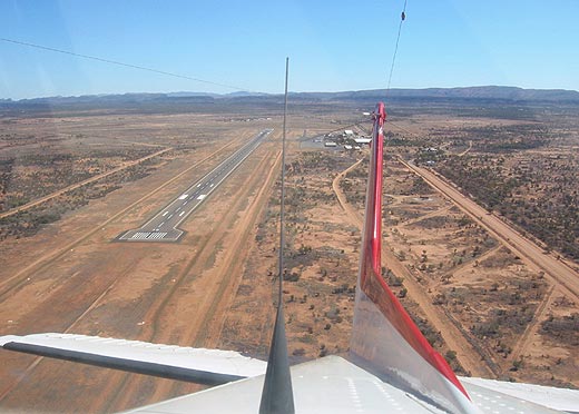 |
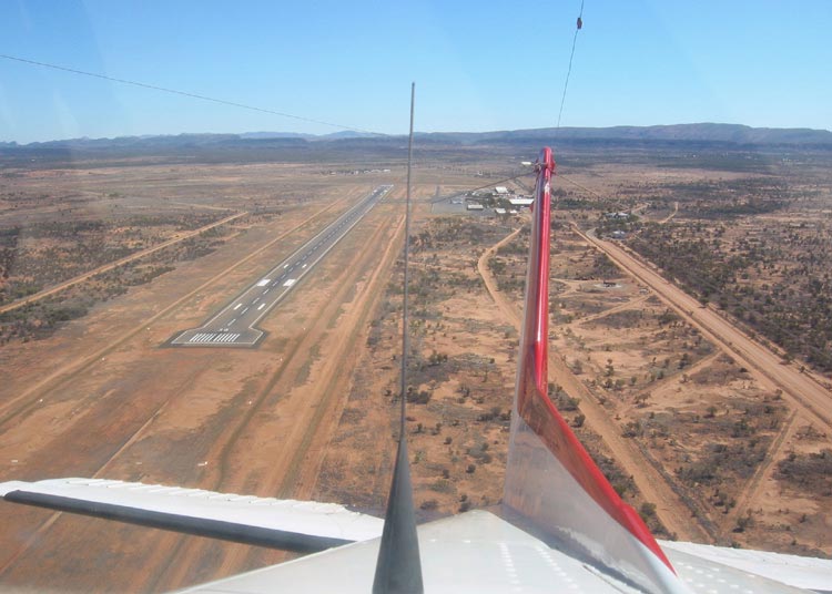
Alice
Springs Airport
(Click on the photo to enlarge) |
 Location
Alice Springs Airport is located 14 kilometres to the south of the township
of Alice Springs, the main entry point to Central Australia.
History
The history of airport site dates back to 1939 when the land was acquired
by the Department of Defence. Development work on the airport commenced
in 1940 in the area then known as the Seven-Mile Aerodrome.
Some civil use of the airport began in 1940. The airport was mainly utilised
by the RAAF and USAF in the early years of the Second World War. By 1944,
Alice Springs Airport had become effectively a transit base for RAAF aircraft
but also an airport facility for civilian airline operations. At the end
of the war the military departed from the aerodrome. In 1946 the Shell
Company of Australia installed the first underground fuel tanks at the
Seven-Mile Aerodrome. A VHF radio range facility and a meteorological
facilities soon followed.
In 1958 the aerodrome became officially known as Alice Springs Airport.
By then the facilities at Alice Springs Airport were becoming inadequate
to cope with the increase in air traffic. This led to the reconstruction
of part of the existing Runway 12/30 and its extension to 2,438m long
which was completed in 1961. The construction of a new terminal building
and fire station followed in 1965 which effectively completed the transfer
of all activity from the Seven-Mile Aerodrome to the current building
area, with the exception of the airport maintenance staff which still
continue to use facilities in the area.
 In 1968 Connellan Airlines shifted from the Town site Aerodrome to Hangar
64 now occupied by AirNorth Central. Facilities for the Alice Springs
Aero Club and a hangar for the Royal Flying Doctor Service (RFDS) were
completed in 1968 and 1969 respectively.
In 1968 Connellan Airlines shifted from the Town site Aerodrome to Hangar
64 now occupied by AirNorth Central. Facilities for the Alice Springs
Aero Club and a hangar for the Royal Flying Doctor Service (RFDS) were
completed in 1968 and 1969 respectively.
Over the ensuing period, additional airport infrastructure was established
including hydrant refuelling facilities, a new meteorological station;
and a hangar by Aboriginal Aircraft Maintenance.
The Federal Airports Corporation (FAC) assumed control of Alice Springs
Airport on 1 April 1989 and occupied an existing converted on-site residence
as the Alice Springs Airport Management Centre.
Helicentre (now Aircraft Engineering NT) began operations in Hangar 115
as a helicopter/aircraft maintenance centre in 1990.
A new passenger terminal was opened on 8 December 1991. This development
increased the capacity of the passenger facilities to accommodate the
expected growth to about 2000.
 In the same year Adlington Airline Catering (now Southern Cross Catering
which also includes Wilson Catering) opened a new flight kitchen and BP
Australia relocated their fuel depot to provide a joint fuel depot with
Shell Australia.
In the same year Adlington Airline Catering (now Southern Cross Catering
which also includes Wilson Catering) opened a new flight kitchen and BP
Australia relocated their fuel depot to provide a joint fuel depot with
Shell Australia.
Progressive development of the general aviation facilities continued throughout
the 1990s.
In 1996 the Royal Flying Doctor Service relocated to a new purpose built
hangar complex on the general aviation apron. Aboriginal Aircraft Maintenance
and Services constructed a second hangar in 1997.
On 10 June 1998, Northern Territory Airports Pty Ltd obtained a 50-year
lease, plus a 49 year option from the Commonwealth Government to manage
and develop the civil area of Alice Springs International Airport.
Virgin Blue
It is speculated that Virgin Blue, which ceased operations to Sydney
in November 2004 and to Adelaide in September 2005, may make a return
to the red centre using its new Embraer E-Jets. As of February 2008, nothing
has been confirmed with Virgin Blue having not made an official announcement
regarding the return, however the carrier has announced direct daily services
to and from nearby Ayers Rock Airport from August 2010.
Street Address:
Santa Teresa Road, Alice Springs
Postal Address:
P O Box 796,
Alice Springs NT 0871
Australia
Email: information asp at ntairports com
au
Telephone (Main Reception): 61 8 8951 1211
Facsimile: Management Centre 61 8 8955 5046; Terminal Control Centre
61 8 89 555 330
URL: Alice Springs Airport
Images and information placed above are from
Alice Springs Airport
http://en.wikipedia.org/wiki/Alice_Springs_Airport
We thank them for the data!
| General Info
|
| Country |
Australia
|
| ICAO ID |
YBAS
|
| Time |
UTC+9:30
|
| Latitude |
-23.806667
23° 48' 24.00" S
|
| Longitude |
133.902222
133° 54' 08.00" E
|
| Elevation |
1789 feet
545 meters
|
| Type |
Civil
|
| Magnetic Variation |
005° E (01/04)
|
| Beacon |
Yes
|
| Operating Agency |
CIVIL GOVERNMENT, (LANDING FEES AND DIPLOMATIC CLEARANCE MAY BE REQUIRED)
|
| Daylight Savings Time |
Dates notified by NOTAM
|
| Communications
|
TWR
Opr 2200-0930Z
|
118.3
|
MTAF
(Outside twr hrs)
|
118.3
|
| MELBOURNE CNTR |
119.8
|
ATIS
Opr 2200-0930Z
|
115.9
335.0
|
| Communications Remarks |
|
| FSS |
(on gnd)
|
| MISC |
Nstd wi CTLZ to 6500'.
|
| Runways
|
| ID |
Dimensions |
Surface |
PCN |
ILS
|
| 06/24 |
3376 x 60 feet
1029 x 18 meters |
COMPOSITE, 50 PERCENT OR MORE OF THE RUNWAY LENGTH IS PERMANENT. |
- |
NO
|
| 12/30 |
7999 x 148 feet
2438 x 45 meters |
ASPHALT |
060FBXU |
YES
|
| 17/35 |
3717 x 60 feet
1133 x 18 meters |
ASPHALT |
- |
NO
|
| Navaids
|
| Type |
ID |
Name |
Channel |
Freq |
Distance From Field |
Bearing From Navaid
|
| VOR-DME |
AS |
ALICE SPRINGS |
106X |
115.9 |
1.6 NM |
116.7
|
| NDB |
WAY |
WALLABY |
- |
372 |
8.1 NM |
294.6
|
| Supplies/Equipment
|
| Fuel |
Jet A1+, Jet A1 with icing inhibitor.
Jet A1, without icing nhibitor.
100/130 MIL Spec, low lead, aviation gasoline (BLUE)
|
| Remarks
|
| CAUTION |
Manned balloon act in vcnty arpt SR and early morning. BASH.
|
| CSTMS/AG/IMG |
Avbl PN rqr.
|
| FUEL |
A1+(Dunnicliffe Aviation fone C61 08 8952 1120, OT C61 08 8952 6752. Avbl 2230-0730 Z)(NC-100LL, A1 avbl 2230-0730 fone C08 8952 1637)
|
| LGT |
Rwy 12 apch lgt 90 min PN. fone C08 8951 1201; OT C08 8952 5046. Fees may apply.Portable lgt PN.
|
| MISC |
Rwy 06-24 2400' asphalt SW end. Rwy 12-30 grooved. Ldg fee.
|
| OIL |
O-117.
|
| RSTD |
Ltd prk for acft abv GWT 12,500 lb; 48 hr PPR fr arpt drct for tran acft. Acft abv GWT 176,000 lb must use turn-around at end of Rwy 12-30 for 180 turns. Twy Enot avbl to acft abv GWT 135,800 lb, or 202 psi tire pressure.
|
Runway 06/24
3376 x 60 feet
1029 x 18 meters
| Runway 06
|
| Surface |
COMPOSITE, 50 PERCENT OR MORE OF THE RUNWAY LENGTH IS PERMANENT.
|
| True Heading |
060.0
|
| Latitude |
-23.803817
23° 48' 13.74" S
|
| Longitude |
133.886653
133° 53' 11.95" E
|
| Elevation |
1779.0 feet
542 meters
|
| Slope |
0.2°
|
| Landing Distance |
3376 feet
1029 meters
|
| Takeoff Distance |
3376 feet
1029 meters
|
| Lighting System |
PORTABLE
|
| Runway 24
|
| Surface |
COMPOSITE, 50 PERCENT OR MORE OF THE RUNWAY LENGTH IS PERMANENT.
|
| True Heading |
240.0
|
| Latitude |
-23.799100
23° 47' 56.76" S
|
| Longitude |
133.895358
133° 53' 43.29" E
|
| Elevation |
1785.0 feet
544 meters
|
| Slope |
-0.2°
|
| Landing Distance |
3376 feet
1029 meters
|
| Takeoff Distance |
3376 feet
1029 meters
|
| Lighting System |
PORTABLE
|
Runway 12/30
7999 x 148 feet
2438 x 45 meters
| Runway 12
|
| Surface |
ASPHALT
|
| True Heading |
120.0
|
| Latitude |
-23.801028
23° 48' 03.70" S
|
| Longitude |
133.893342
133° 53' 36.03" E
|
| Elevation |
1786.0 feet
544 meters
|
| Slope |
-0.3°
|
| Landing Distance |
7999 feet
2438 meters
|
| Takeoff Distance |
7999 feet
2438 meters
|
| Lighting System |
HIRL
J
VA
PORTABLE |
| Runway 30
|
| Surface |
ASPHALT
|
| True Heading |
300.0
|
| Latitude |
-23.812125
23° 48' 43.65" S
|
| Longitude |
133.914008
133° 54' 50.43" E
|
| Elevation |
1763.0 feet
537 meters
|
| Slope |
0.3°
|
| Landing Distance |
7999 feet
2438 meters
|
| Takeoff Distance |
7999 feet
2438 meters
|
| Lighting System |
HIRL
VA
PORTABLE |
Runway 17/35
3717 x 60 feet
1133 x 18 meters
| Runway 17
|
| Surface |
ASPHALT
|
| True Heading |
178.0
|
| Latitude |
-23.797278
23° 47' 50.20" S
|
| Longitude |
133.886539
133° 53' 11.54" E
|
| Elevation |
1789.0 feet
545 meters
|
| Slope |
-0.3°
|
| Landing Distance |
3717 feet
1133 meters
|
| Takeoff Distance |
3717 feet
1133 meters
|
| Lighting System |
PORTABLE
|
| Runway 35
|
| Surface |
ASPHALT
|
| True Heading |
358.0
|
| Latitude |
-23.807483
23° 48' 26.94" S
|
| Longitude |
133.886881
133° 53' 12.77" E
|
| Elevation |
1778.0 feet
542 meters
|
| Slope |
0.3°
|
| Landing Distance |
3717 feet
1133 meters
|
| Takeoff Distance |
3717 feet
1133 meters
|
| Lighting System |
PORTABLE
|
Navaids
| ALICE SPRINGS
|
| Type |
ID |
Channel |
Freq |
Country |
State
|
| NDB |
AS |
- |
335 |
Australia |
-
|
| Latitude |
Longitude |
Airport
|
-23.777939
23° 46' 40.58" S |
133.873525
133° 52' 24.69" E |
YBAS
|
| ALICE SPRINGS
|
| Type |
ID |
Channel |
Freq |
Country |
State
|
| VOR-DME |
AS |
106X |
115.9 |
Australia |
-
|
| Latitude |
Longitude |
Airport
|
-23.792889
23° 47' 34.40" S |
133.878203
133° 52' 41.53" E |
YBAS
|
Navaids
| WALLABY
|
| Type |
ID |
Channel |
Freq |
Country |
State
|
| NDB |
WAY |
- |
372 |
Australia |
-
|
| Latitude |
Longitude |
Airport
|
-23.874233
23° 52' 27.24" S |
134.029836
134° 01' 47.41" E |
YBAS
|
The content above was published at Airports-Worldwide.com in 2004-2006.
We don't guarantee the information is fresh and accurate. The data may be wrong or outdated.
For more up-to-date information please refer to other sources.
|
 |