|
 |
|
||||
|
By
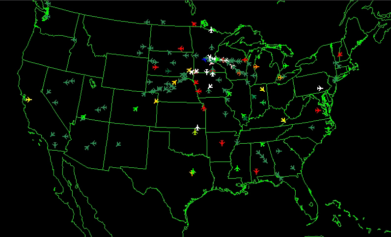
Wikipedia, Flight Traffic Mapping uses animation to depict flight traffic. The mapping of flights in real-time is based on a sophisticated air traffic control system that was developed for North America. The air traffic control system is a complex combination of electronics and people that helps guide planes from departure to destination. In 1991, data on the location of aircraft was made available by the Federal Aviation Administration to the airline industry. The National Business Aviation Association (NBAA), the General Aviation Manufacturers Association, the Aircraft Owners & Pilots Association, the Helicopter Association International, and the National Air Transportation Association petitioned the FAA to make ASDI information available on a "need-to-know" basis. Subsequently, NBAA advocated the broad-scale dissemination of flight traffic data. The Aircraft Situational Display to Industry (ASDI) system now conveys up-to-date information on flights to the airline industry and the public. Three companies distribute ASDI information, FlightExplorer, FlightView, and FlyteComm. Each company maintains a website that provides free updated information to the public on flight status. FlyteTrax, a product of FlyteComm, is a Windows-based program for displaying the geographic location of airborne IFR (Instrument Flight Rules) air traffic anywhere in the FAA air traffic system. Positions are reported for both commercial and general aviation traffic. The program can overlay air traffic with a wide selection of maps such as, geo-political boundaries, air traffic control center boundaries, high altitude jet routes, satellite cloud and radar imagery.
All inbound and outbound traffic for Minneapolis/St. Paul (MSP) airport on a weekday at 12:52 PM CDT from Animated Atlas: Flight Traffic over North America Animated Atlas of Air Traffic over North AmericaThe maps in this electronic atlas are animations depicting flight traffic over North America. All animations depict traffic over a 24-hour period as a time-lapse and were captured during the period of March 2003 to September 2005. The location of airplanes was mapped using FlyteTrax from FlyteComm, Inc. The program updates the position of flights every minute and also allows for the selection of flights based on the aircraft, airline, and the departure or arrival airport. Over 70 individual animations are included on the DVD that can be played at three differ Peterson, Michael P. & Wendel, Jochen. (2007) North American Animated Flight Atlas, Journal of Maps, v2007, 98-106. External links
Text from Wikipedia is available under the Creative Commons Attribution/Share-Alike License; additional terms may apply.
Published in July 2009. Click here to read more articles related to aviation and space!
|

 |
|
Copyright 2004-2026 © by Airports-Worldwide.com, Vyshenskoho st. 36, Lviv 79010, Ukraine Legal Disclaimer |