|
|
Coordinates: 27°26′59″S 059°03′22″W / 27.44972°S 59.05611°W / -27.44972; -59.05611
Resistencia Internacional Airport
Aeropuerto Internacional de Resistencia |
 |
| IATA: RES – ICAO: SARE |
| Summary |
| Airport type |
Public / Military |
| Operator |
Government and Aeropuertos Argentina 2000 |
| Serves |
Resistencia, Chaco |
| Location |
Ruta N11, Km 1003.4, Resistencia (H3500) |
| Elevation AMSL |
170 ft / 52 m |
| Runways |
| Direction |
Length |
Surface |
| m |
ft |
| 03/21 |
2,850 |
9,344 |
Asphalt |
| Statistics (2007) |
| Total Passengers |
99,169 |
| Source: DAFIF |
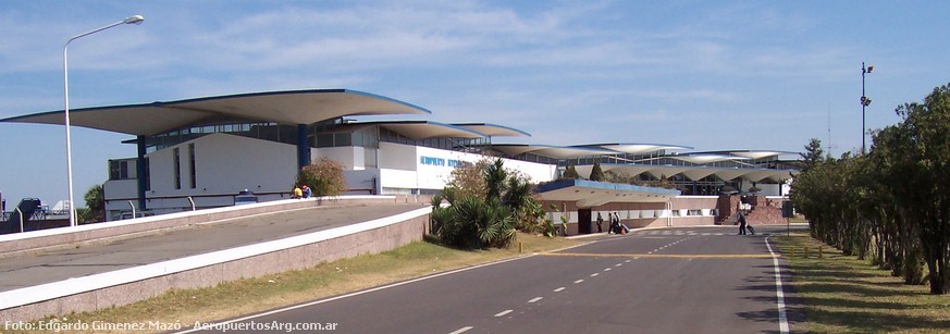
Resistencia International Airport (Spanish: Aeropuerto Internacional de Resistencia) (IATA: RES, ICAO: SARE) is an airport in Chaco Province, Argentina serving the city of Resistencia, built in 1965 while the terminal was completed in 1971. It is also known as Aeropuerto de Resistencia General José de San Martín.
It has a 6,500 square metres (70,000 sq ft) passenger terminal, 128,850 square metres (1,386,900 sq ft) of runways, a 3.5 hectares (8.6 acres) platform (which can support large airliners such as a Boeing 747), has a parking place for 150 cars and it is the base of the RANE (Región Aérea Noreste). In 2007, 99,169 passengers left Resistencia in 2,957 flights.
It is operated by Aeropuertos Argentina 2000. Doctor Fernando Piragine Niveyro International Airport, serving Corrientes, is 16 km (10 mi) from this airport, and it is usual to fly from one and return to the other.
Airlines and destinations
| Airlines |
Destinations |
| Aerochaco |
Buenos Aires-Aeroparque, Córdoba,Roque Sáenz Peña |
| Aerolíneas Argentinas |
Buenos Aires-Aeroparque |
The above content comes from Wikipedia and is published under free licenses – click here to read more.
| General Info
|
| Country |
Argentina
|
| ICAO ID |
SARE
|
| Time |
UTC-3
|
| Latitude |
-27.449986
27° 26' 59.95" S
|
| Longitude |
-59.056125
059° 03' 22.05" W
|
| Elevation |
173 feet
53 meters
|
| Type |
Civil
|
| Magnetic Variation |
010° W (05/06)
|
| Operating Agency |
CIVIL GOVERNMENT, (LANDING FEES AND DIPLOMATIC CLEARANCE MAY BE REQUIRED)
|
| Operating Hours |
24 HOUR OPERATIONS
|
| Communications
|
| TWR/APP |
118.7
118.1
|
| RDO |
122.3
|
| RESISTENCIA |
119.5
|
| Runways
|
| ID |
Dimensions |
Surface |
PCN |
ILS
|
| 03/21 |
9088 x 147 feet
2770 x 45 meters |
ASPHALT |
074FBWT |
YES
|
| Navaids
|
| Type |
ID |
Name |
Channel |
Freq |
Distance From Field |
Bearing From Navaid
|
| VOR-DME |
SIS |
RESISTENCIA |
098X |
115.1 |
At Field |
-
|
| Supplies/Equipment
|
| Fuel |
Jet A1, without icing nhibitor.
100/130 MIL Spec, low lead, aviation gasoline (BLUE)
|
| Remarks
|
| CAUTION |
Bird haz. Ant off both ends of Rwy.
|
| CSTMS/AG/IMG |
IMG avbl H24.
|
| FUEL |
(NC-100LL, A1)
|
The content above was published at Airports-Worldwide.com in 2010.
We don't guarantee the information is fresh and accurate. The data may be wrong or outdated.
For more up-to-date information please refer to other sources.
|
|