 |
|
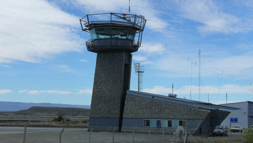
Comandante Armando Tola International Airport
Aeropuerto Internacional de El Calafate - Comandante Armando Tola |
 |
| IATA: FTE – ICAO: SAWC |
| Summary |
| Airport type |
Public / Military |
| Operator |
Government and London Supply |
| Serves |
El Calafate, Santa Cruz |
| Location |
Camino al Aeropuerto, km 23. (Z9405) El Calafate |
| Elevation AMSL |
669 ft / 204 m |
| Coordinates |
50°16′48.90″S 72°03′11.50″W / 50.28025°S 72.053194°W / -50.28025; -72.053194 |
| Runways |
| Direction |
Length |
Surface |
| m |
ft |
| 07/25 |
2,649 |
8,688 |
Concrete |
| Source: DAFIF |
Comandante Armando Tola International Airport (Spanish: Aeropuerto International de El Calafate - Comandante Armando Tola) (IATA: FTE, ICAO: SAWC) is an airport in Santa Cruz Province, Argentina. It is located approximately 21 km (13 mi) east of the city of El Calafate. The airport is jointly operated by the government and London Supply. Currently, the airport is only served by Aerolíneas Argentinas, LAN Argentina and LADE.
The airport was inaugurated in November 2000, replacing the old Lago Argentino Airport (ING/SAWL) which was obsolete. It is now the main entrance to Los Glaciares National Park. The airport's design was created by Carlos Ott, a famous architect from Uruguay. In 2007 the airport was used by over 400,000 passengers.
Airlines and destinations
| Airlines |
Destinations |
| Aerochaco |
Córdoba |
| Aerolíneas Argentinas |
Buenos Aires-Aeroparque, Trelew, Ushuaia |
| LADE |
Bariloche, Buenos Aires-Aeroparque, Comodoro Rivadavia, Gobernador Gregores, Mar del Plata, Perito Moreno, Puerto Madryn, Río Grande, Río Gallegos, Ushuaia |
| LAN Argentina |
Buenos Aires-Aeroparque, Ushuaia |
The above content comes from Wikipedia and is published under free licenses – click here to read more.
| General Info
|
| Country |
Argentina
|
| ICAO ID |
SAWC
|
| Time |
UTC-3
|
| Latitude |
-50.280322
50° 16' 49.16" S
|
| Longitude |
-72.053103
072° 03' 11.17" W
|
| Elevation |
669 feet
204 meters
|
| Magnetic Variation |
013° E (05/06)
|
| Operating Agency |
CIVIL GOVERNMENT, (LANDING FEES AND DIPLOMATIC CLEARANCE MAY BE REQUIRED)
|
| Communications
|
| GND |
121.8
|
| APP/TWR |
119.95
118.2
|
| Runways
|
| ID |
Dimensions |
Surface |
PCN |
ILS
|
| 07/25 |
8366 x 147 feet
2550 x 45 meters |
CONCRETE. |
- |
NO
|
| Navaids
|
| Type |
ID |
Name |
Channel |
Freq |
Distance From Field |
Bearing From Navaid
|
| VOR-DME |
ECA |
EL CALAFATE |
094X |
114.7 |
At Field |
-
|
| NDB |
ECA |
EL CALAFATE |
- |
385 |
At Field |
-
|
| Remarks
|
| FUEL |
(NC-A, A1)
|
| OPR HOURS |
Opr 1100-2400Z
|
The content above was published at Airports-Worldwide.com in 2010.
We don't guarantee the information is fresh and accurate. The data may be wrong or outdated.
For more up-to-date information please refer to other sources.
|
|


