|
|
Mcmurdo Station Pegasus Field Airport |
Pegasus Field (ICAO: NZPG) was an airstrip in Antarctica, the southernmost of three airfields serving McMurdo Station. It closed due to excessive melting in the summer season caused by warmer temperatures combined with dust and dirt blown in from nearby Black Island. The last flight was on December 8, 2016 and it was replaced by Phoenix Airfield (ICAO: NZFX) with flights expected to start in February 2017.
Pegasus Field |
|---|
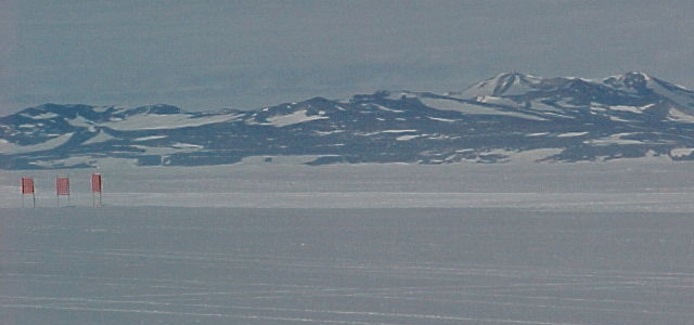
White ice runway at Pegasus Field
|
|
| |
| Location | McMurdo Station, Ross Island, Antarctica |
|---|
| Elevation AMSL |
18 ft / 5 m |
|---|
| Coordinates |
77°57′48″S 166°31′28″E / 77.96333°S 166.52444°E / -77.96333; 166.52444 |
|---|
|
|
NZPG
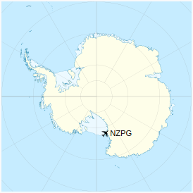
Location of airfield in Antarctica
|
| Direction
|
Length
|
Surface
|
| ft
|
m
|
| 15/33
|
10,000
|
3,048
|
Ice
|
| 08/26
|
10,000
|
3,048
|
Ice
|
| Source: DAFIF |
Pegasus was originally conceived as a blue ice runway capable of handling wheeled aircraft year-round, but as it was developed, it was enhanced with a 4-inch layer of compacted snow on top—thus more properly characterizing it as a white ice runway. Other local runways are the snow runways at Williams Field (ICAO: NZWD) that are limited to ski-equipped aircraft, and the Ice Runway (ICAO: NZIR) on the sea-ice available during the summer Antarctic field season.
The field is named after Pegasus, a C-121 Lockheed Constellation that made a forced landing on unprepared terrain in bad weather on October 8, 1970. None of the 80 on board were seriously injured. The aircraft remains in-situ near the airfield as of 2019, and has remained well preserved. It is generally covered with snow, but is occasionally excavated by visitors wishing to photograph it.
On September 11, 2008, a United States Air Force C-17 Globemaster III successfully completed the first landing in Antarctica using night-vision goggles at Pegasus Field. Previously air transport in the permanent darkness of the winter was only used in emergencies, with burning barrels of fuel to outline the runway.
Gallery

United States Air Force C-5 Galaxy being off-loaded at Pegasus Field.

RNZAF Boeing 757 lands at Pegasus Airfield on the Ross Ice Shelf during its maiden flight to Antarctica. WN 10-0063-045 Crown Copyright 2011, NZ Defence Force – Some Rights Reserved. CC BY 2.0.
Text from Wikipedia is available under the Creative Commons Attribution/Share-Alike License; additional terms may apply.
| General Info
|
| Country |
Antarctica
|
| ICAO ID |
NZPG
|
| Time |
UTC+12(+13DT)
|
| Latitude |
-77.963441
77° 57' 48.39" S
|
| Longitude |
166.524609
166° 31' 28.59" E
|
| Elevation |
18 feet
5 meters
|
| Magnetic Variation |
144° E (05/06)
|
| Communications
|
| INTL DISTRESS |
2182
4123
|
| MCMURDO CNTR |
118.2
360.2
|
| Communications Remarks |
|
| EMR |
(2182 As rqr)(4123 USAP)
|
| CNTR |
(9032 11256 57275 SSB) Grd freqs cont mnt during opr season, nml 1 Oct to 25 Febannually.
|
| Runways
|
| ID |
Dimensions |
Surface |
PCN |
ILS
|
| 15/33 |
10000 x 220 feet
3048 x 67 meters |
ICE. |
- |
NO
|
| Navaids
|
| Type |
ID |
Name |
Channel |
Freq |
Distance From Field |
Bearing From Navaid
|
| TACAN |
ZPG |
PEGASUS |
080X |
- |
At Field |
-
|
| Remarks
|
| CAUTION |
Svc avbl on req for sked USAP OPS. Unctl arpt avbl fr aprx 15 AUG to 25 FEB. Rwybrg strength surveyed for USAP acft only - ALL OTHERS USE AT OWN RISK. Prior arng for Austral win use. (See FLIP planning AP/3). For addn info call C-1-843-218-5757. Afld const Sep-Dec annually. When opr, emerg/wx div coord thru MAC Cntr 45 min prior when possible. When opr, rwy sfc conditions rpt compacted snow with up to 2 in of loose snow.
|
| FLUID |
1(LHNIT)
|
| FUEL |
JP-8
|
| JASU |
2(GTC-85) 2(ESSEX B809)
|
| MISC |
No hgr space avbl. Rwy mrk with 4' x 4' black panels at 400' intervals for the entire len of rwy. Heliport lctd S77 51.1' E166 42.8, elev 60', for USAP participants only. Lcl std time equivalent to NZ lcl std time. 6(NGH heaters). Tmpry chgand other NOTAM info related to afld are publ on MCMURDO.USAP.GOV
|
| OIL |
O-156
|
| RSTD |
180 turns only at dep end Rwy 33. When possible land Rwy 33. Eng start and taxiwith flaps up. All acft C-130 or larger shall taxi on rwy with either inbd or outbd eng shut down. C-130 acft or smaller prk Ramp 2 (grid W). Eng runs on rampproh. PPR for copter OPS fr United States Antarctic Program (USAP) afld mgr. Copter OPS Ramp 2 (grid W). When acft prk Ramp 1 (grid E), rwy clsd unless acft lndRwy 33. PPR fr USAP afld mgr for aircrews to leave perimeter of ramp.
|
The content above was published at Airports-Worldwide.com in 2023.
We don't guarantee the information is fresh and accurate. The data may be wrong or outdated.
For more up-to-date information please refer to other sources.
|
|