|
|
Soyo Airport (IATA: SZA, ICAO: FNSO) is an airport serving Soyo, a city in Zaire Province in Angola.
The runway has an additional 150 metres (490 ft) displaced threshold on each end, for a total paved length of 2,122 metres (6,962 ft).
The Soyo non-directional beacon (Ident: SO) is located on the field.
|
Soyo Airport
|
|
|
| Summary |
| Airport type |
Public |
| Operator |
Government |
| Serves |
Soyo |
| Elevation AMSL |
15 ft / 5 m |
| Coordinates |
6°8′27.8″S
12°22′18.6″E |
| Map |
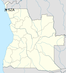
Location of Soyo Airport in Angola
|
| Runways |
| Direction |
Length |
Surface |
| m |
ft |
| 06/24 |
1,822 |
5,978 |
Asphalt |
|
Airlines and destinations
| Destinations |
| TAAG Angola Airlines |
Luanda |
The above content comes from Wikipedia and is published under free licenses – click here to read more.
| General Info
|
| Country |
Angola
|
| ICAO ID |
FNSO
|
| Time |
UTC+1
|
| Latitude |
-6.141086
06° 08' 27.91" S
|
| Longitude |
12.371764
012° 22' 18.35" E
|
| Elevation |
15 feet
5 meters
|
| Magnetic Variation |
004° W (05/06)
|
| Operating Agency |
CIVIL GOVERNMENT, (LANDING FEES AND DIPLOMATIC CLEARANCE MAY BE REQUIRED)
|
| Operating Hours |
SUNRISE TO SUNSET (SR-SS)
|
| Runways
|
| ID |
Dimensions |
Surface |
PCN |
ILS
|
| 07/25 |
6857 x 174 feet
2090 x 53 meters |
ASPHALT |
- |
NO
|
| Navaids
|
| Type |
ID |
Name |
Channel |
Freq |
Distance From Field |
Bearing From Navaid
|
| NDB |
SO |
SOYO |
- |
310 |
At Field |
-
|
| Remarks
|
| OPR HOURS |
Opr SR-SS.
|
The content above was published at Airports-Worldwide.com in 2020.
We don't guarantee the information is fresh and accurate. The data may be wrong or outdated.
For more up-to-date information please refer to other sources.
|
|