|
|
Nzagi Airport (IATA: NZA, ICAO: FNZG) is an airport serving Nzagi (Andrada) in the Lunda Norte Province, in northeastern Angola.
|
Nzagi Airport
|
|
|
| Summary |
| Airport type |
Public |
| Operator |
Government |
| Serves |
Nzagi (Andrada), Angola |
| Elevation AMSL |
2,431 ft / 741 m |
| Coordinates |
7°43′00″S
21°21′25″E |
| Map |
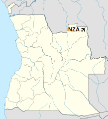
Location of Nzagi Airport in Angola
|
| Runways |
| Direction |
Length |
Surface |
| m |
ft |
| 08/26 |
2,310 |
7,579 |
Dirt |
|
The above content comes from Wikipedia and is published under free licenses – click here to read more.
| General Info
|
| Country |
Angola
|
| ICAO ID |
FNZG
|
| Time |
UTC+1
|
| Latitude |
-7.716944
07° 43' 01.00" S
|
| Longitude |
21.358166
021° 21' 29.40" E
|
| Elevation |
2431 feet
741 meters
|
| Magnetic Variation |
002° W (05/06)
|
| Operating Agency |
CIVIL GOVERNMENT, (LANDING FEES AND DIPLOMATIC CLEARANCE MAY BE REQUIRED)
|
| Runways
|
| ID |
Dimensions |
Surface |
PCN |
ILS
|
| 08/26 |
5906 x 68 feet
1800 x 21 meters |
ASPHALT |
- |
NO
|
| Remarks
|
| OPR HOURS |
Opr SR-SS.
|
The content above was published at Airports-Worldwide.com in 2020.
We don't guarantee the information is fresh and accurate. The data may be wrong or outdated.
For more up-to-date information please refer to other sources.
|
|