|
|
Negage Airport (IATA: GXG, ICAO: FNNG) is an airport serving Negage, a town and municipality in Uíge Province in Angola. It was formerly a Portuguese military airbase.
The Negage non-directional beacon (Ident NG) is reportedly on the airfield.
|
Negage Airport
|
|
|
| Summary |
| Airport type |
Public |
| Serves |
Negage, Angola |
| Elevation AMSL |
4,105 ft / 1,251 m |
| Coordinates |
7°45′15″S
15°17′15″E |
| Map |
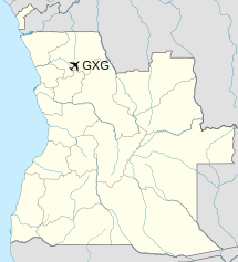
Location of Negage Airport in Angola
|
| Runways |
| Direction |
Length |
Surface |
| m |
ft |
| 16/34 |
2,400 |
7,874 |
Asphalt |
| 09/27 |
800 |
2,625 |
Dirt |
|
History
The present airport was built by the Portuguese Air Force, being inaugurated in 7 February 1961, as the Aerodrome-Base nº 3 (AB3, Aeródromo-Base nº 3). The base had an important role during the Angolan War of Independence. Besides the main airfield at Negage, the AB3 also controlled two satellite maneuver airfields, one at Maquela do Zombo (AM31) and the other at Toto (AM32).
The above content comes from Wikipedia and is published under free licenses – click here to read more.
| General Info
|
| Country |
Angola
|
| ICAO ID |
FNNG
|
| Time |
UTC+1
|
| Latitude |
-7.754506
07° 45' 16.22" S
|
| Longitude |
15.287728
015° 17' 15.82" E
|
| Elevation |
4105 feet
1251 meters
|
| Magnetic Variation |
004° W (05/06)
|
| Operating Agency |
MILITARY
|
| Communications
|
| AFIS |
118.7
|
| Runways
|
| ID |
Dimensions |
Surface |
PCN |
ILS
|
| 16/34 |
7874 x 98 feet
2400 x 30 meters |
ASPHALT |
- |
NO
|
| Navaids
|
| Type |
ID |
Name |
Channel |
Freq |
Distance From Field |
Bearing From Navaid
|
| NDB |
NG |
NEGAGE |
- |
220 |
At Field |
-
|
| Remarks
|
| OPR HOURS |
Opr SR-SS.
|
The content above was published at Airports-Worldwide.com in 2020.
We don't guarantee the information is fresh and accurate. The data may be wrong or outdated.
For more up-to-date information please refer to other sources.
|
|