|
|
Lobito Airport (Portuguese: Aeroporto do Lobito) (IATA: LLT, ICAO: FNLB) is an airport serving in Lobito, a town and municipality in the Benguela Province of Angola.
|
Lobito Airport
Aeroporto do Lobito
|
|
|
| Summary |
| Airport type |
Military |
| Location |
Lobito, Angola |
| Elevation AMSL |
10 ft / 3 m |
| Coordinates |
12°22′20″S
13°32′15″E |
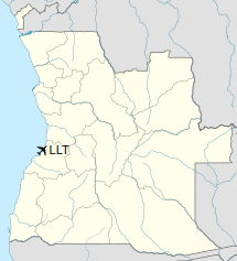
| Map |
Location of Lobito Airport in Angola
|
| Runways |
| Direction |
Length |
Surface |
| m |
ft |
| 16/34 |
1,500 |
4,921 |
Asphalt |
|
Accidents and incidents
- On 15 December 1994, Basler BT-67 N96BF of SL Aviation Services was damaged beyond repair in a take-off accident when flight was attempted with insufficient airspeed. Both crew were killed.
- On 21 August 1995, a Douglas DC-3 that had been converted to turboprop engines was written off at Lobito Airport.
The above content comes from Wikipedia and is published under free licenses – click here to read more.
| General Info
|
| Country |
Angola
|
| ICAO ID |
FNLB
|
| Time |
UTC+1
|
| Latitude |
-12.371233
12° 22' 16.44" S
|
| Longitude |
13.536625
013° 32' 11.85" E
|
| Elevation |
10 feet
3 meters
|
| Type |
Military
|
| Magnetic Variation |
007° W (05/06)
|
| Operating Agency |
MILITARY
|
| Operating Hours |
SEE REMARKS FOR OPERATING HOURS OR COMMUNICATIONS FOR POSSIBLE HOURS
|
| Communications
|
RDO
SR-SS
|
118.3
|
| Runways
|
| ID |
Dimensions |
Surface |
PCN |
ILS
|
| 16/34 |
4920 x 98 feet
1500 x 30 meters |
ASPHALT |
- |
NO
|
| Navaids
|
| Type |
ID |
Name |
Channel |
Freq |
Distance From Field |
Bearing From Navaid
|
| NDB |
LB |
LOBITO |
- |
380 |
At Field |
-
|
| Supplies/Equipment
|
| Fuel |
Jet B, Wide cut turbine fuel, Without icing inhibitor.
100/130 MIL Spec, low lead, aviation gasoline (BLUE)
|
| Remarks
|
| FUEL |
(NC-100LL, B)
|
| OPR HOURS |
Opr 0600-1700Z.
|
The content above was published at Airports-Worldwide.com in 2020.
We don't guarantee the information is fresh and accurate. The data may be wrong or outdated.
For more up-to-date information please refer to other sources.
|
|