|
|
Dundo Airport (IATA: DUE, ICAO: FNDU) is an airport serving the city of Dundo, the capital of Lunda Norte Province in Angola.
The Dundo (Ident: DU) non-directional beacon is located on the field.
|
Dundo Airport
|
|
|
| Summary |
| Airport type |
Public |
| Operator |
Government |
| Serves |
Dundo |
| Elevation AMSL |
2,451 ft / 747 m |
| Coordinates |
7°24′05″S
20°49′05″E |
| Map |
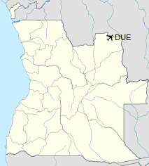
Location of Airport in Angola
|
| Runways |
| Direction |
Length |
Surface |
| m |
ft |
| 04/22 |
2,500 |
8,202 |
Asphalt |
|
Airlines and destinations
| Destinations |
| Fly Angola |
Luanda |
| TAAG Angola Airlines |
Luanda |
The above content comes from Wikipedia and is published under free licenses – click here to read more.
| General Info
|
| Country |
Angola
|
| ICAO ID |
FNDU
|
| Time |
UTC+1
|
| Latitude |
-7.400892
07° 24' 03.21" S
|
| Longitude |
20.818481
020° 49' 06.53" E
|
| Elevation |
2451 feet
747 meters
|
| Magnetic Variation |
002° W (05/06)
|
| Operating Agency |
CIVIL GOVERNMENT, (LANDING FEES AND DIPLOMATIC CLEARANCE MAY BE REQUIRED)
|
| Communications
|
| AFIS |
118.3
|
| Runways
|
| ID |
Dimensions |
Surface |
PCN |
ILS
|
| 04/22 |
6468 x 80 feet
1971 x 24 meters |
ASPHALT |
- |
NO
|
| Navaids
|
| Type |
ID |
Name |
Channel |
Freq |
Distance From Field |
Bearing From Navaid
|
| NDB |
CH |
CHITATO |
- |
350 |
At Field |
-
|
The content above was published at Airports-Worldwide.com in 2020.
We don't guarantee the information is fresh and accurate. The data may be wrong or outdated.
For more up-to-date information please refer to other sources.
|
|